
What makes drone media useful beyond a pretty view?
The best aerial media explains scale, access, nearby anchors, parking, acreage, and neighborhood context that buyers cannot understand from ground photos alone.
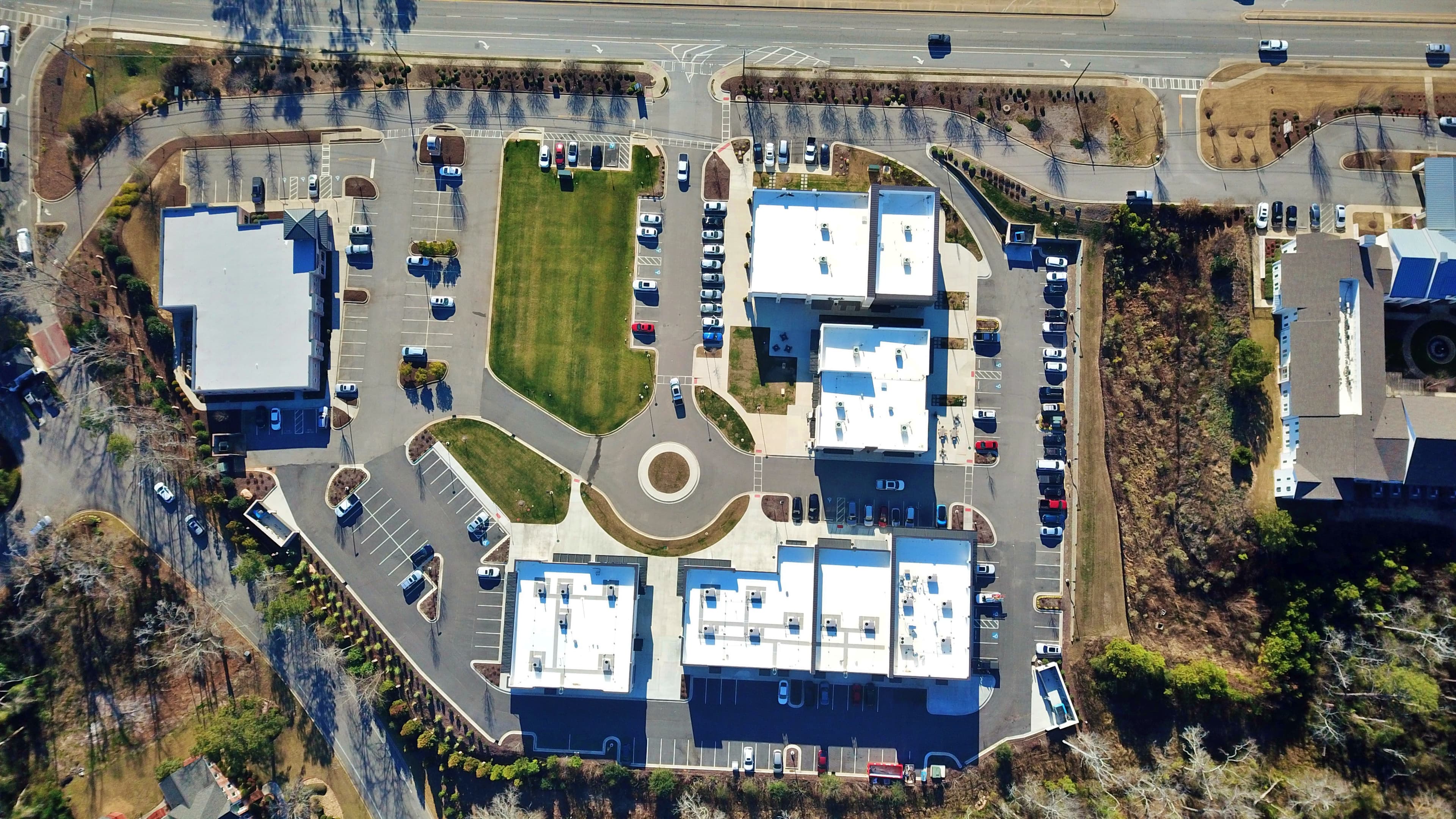
Aerial context, frontage, acreage, and access
For Augusta, North Augusta, Evans, Martinez, Grovetown, Aiken, and CSRA properties, aerial media can show roads, rooflines, water, land, parking, nearby anchors, and the surrounding area in seconds.
Options and uses
The best media package is planned around the property story, not a generic shot list. Use this service when the audience needs a clearer view of the space, location, condition, or progress.
Residential listings with land, water, acreage, or amenities
Commercial real estate frontage and access context
Development sites, retail centers, and hospitality properties
Social media reels, listing films, and stakeholder updates
Deliverables
High-resolution aerial stills
Drone video clips for edited campaigns
Context views for access, parking, rooflines, and surroundings
Flight planning around property value, weather, and access
Process
Identify the property story and the context the ground view cannot show.
Plan safe capture windows around weather, access, and site conditions.
Deliver aerial media that supports the listing, campaign, or report.
FAQ
The best aerial media explains scale, access, nearby anchors, parking, acreage, and neighborhood context that buyers cannot understand from ground photos alone.
Yes. It can support site documentation, progress reporting, insurance photo sets, and commercial property overviews when planned around a clear reporting need.
Service request
Include the address or area, target launch date, square footage or acreage when available, and any must-have views. We will help match the media plan to the property.
Other services
Clean listing photography for homes, commercial spaces, amenities, and property details that need to look accurate, polished, and ready for market.
Video packages that turn property details, aerial context, and room flow into assets for listings, social channels, paid ads, and stakeholder updates.
Immersive Matterport walkthroughs paired with Matterport schematic floor plans so buyers and stakeholders understand both the look and the flow of a property.
Photo, drone, video, and 3D documentation packages built to create a clearer visual record for property conditions, insurance reporting, restoration planning, and stakeholder review.
Scheduled construction progress videos and aerial updates that help teams show what changed, what is complete, and what still needs attention.